
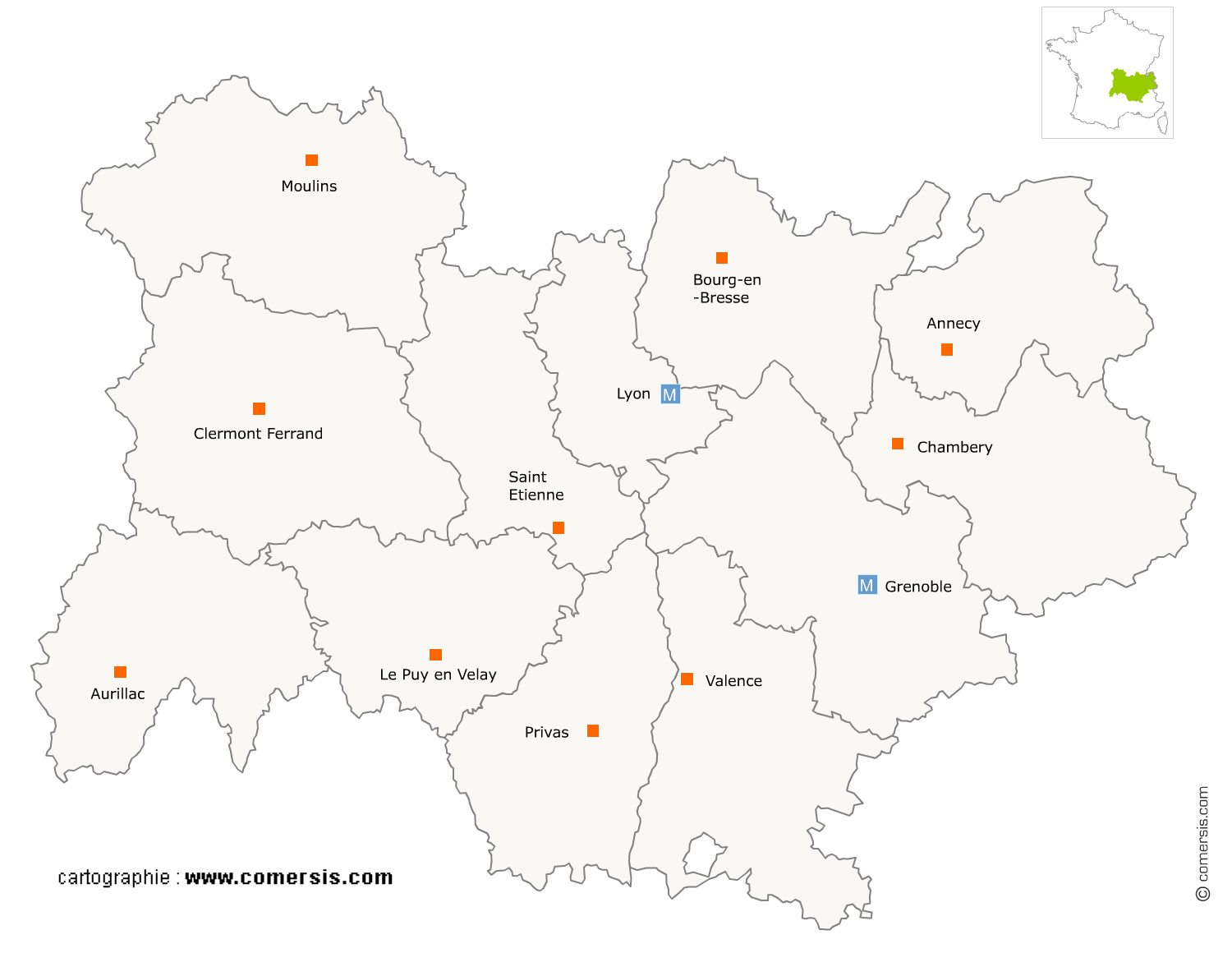
Station service en région Auvergne-Rhône-Alpes
573 stations services sont référencés sur la région Auvergne-Rhône-Alpes
Vous recherchez une pompe à essence en Auvergne-Rhône-Alpes ?
La région Auvergne-Rhône-Alpes représente 9% des stations services de France.
C'est le département du Rhône qui compte le plus de stations services en Auvergne-Rhône-Alpes.
C'est le département du Rhône qui compte le plus de stations services en Auvergne-Rhône-Alpes.
Station service dans le Cantal (15)
Secteur d'Aurillac
Indice d'implantation
| Commune | Nb Pro | Habitants | Distance | |
|---|---|---|---|---|
| Aurillac - 15000 | 5 | 26572 | 0,0 | km |
| le Rouget - 15290 | 1 | 1278 | 18,4 | km |
| Cayrols - 15290 | 1 | 284 | 19,5 | km |
| Glénat - 15150 | 1 | 185 | 20,9 | km |
| Riom-ès-Montagnes - 15400 | 1 | 2733 | 43,0 | km |
Secteur de Saint-Flour
Indice d'implantation
| Commune | Nb Pro | Habitants | Distance | |
|---|---|---|---|---|
| Saint-Flour - 15100 | 2 | 6626 | 0,0 | km |
| Saint-Georges - 15100 | 2 | 1116 | 3,2 | km |
| Laveissière - 15300 | 1 | 552 | 24,4 | km |
Station service dans le Puy-de-Dôme (63)
Secteur de Clermont-Ferrand
Indice d'implantation
| Commune | Nb Pro | Habitants | Distance | |
|---|---|---|---|---|
| Clermont-Ferrand - 63000 | 13 | 141463 | 0,0 | km |
| Aubière - 63170 | 5 | 9717 | 3,7 | km |
| Gerzat - 63360 | 1 | 10404 | 6,9 | km |
| Saint-Genès-Champanelle - 63122 | 1 | 3320 | 8,4 | km |
| Lempdes - 63370 | 1 | 8308 | 8,8 | km |
| le Crest - 63450 | 1 | 1326 | 10,7 | km |
| Veyre-Monton - 63960 | 3 | 3439 | 13,5 | km |
| Aydat - 63970 | 1 | 2259 | 15,7 | km |
| Mazaye - 63230 | 1 | 717 | 17,4 | km |
| Pontgibaud - 63230 | 1 | 705 | 19,0 | km |
| Rochefort-Montagne - 63210 | 1 | 927 | 24,1 | km |
| la Tour-d'Auvergne - 63680 | 1 | 653 | 41,3 | km |
| Bourg-Lastic - 63760 | 1 | 890 | 43,5 | km |
Secteur de Riom
Indice d'implantation
| Commune | Nb Pro | Habitants | Distance | |
|---|---|---|---|---|
| Riom - 63200 | 3 | 18675 | 0,0 | km |
| Sayat - 63530 | 1 | 2187 | 8,5 | km |
| Combronde - 63460 | 1 | 2098 | 10,4 | km |
| Aigueperse - 63260 | 1 | 2666 | 16,4 | km |
| Maringues - 63350 | 1 | 2891 | 17,0 | km |
| Champs - 63440 | 2 | 381 | 18,8 | km |
| Saint-Éloy-les-Mines - 63700 | 2 | 3652 | 37,3 | km |
| Montaigut - 63700 | 1 | 1022 | 40,0 | km |
Secteur d'Issoire
Indice d'implantation
| Commune | Nb Pro | Habitants | Distance | |
|---|---|---|---|---|
| Issoire - 63500 | 6 | 14286 | 0,0 | km |
| Champeix - 63320 | 1 | 1324 | 10,6 | km |
| Vic-le-Comte - 63270 | 1 | 4934 | 11,1 | km |
| Authezat - 63114 | 1 | 661 | 11,2 | km |
| Brassac-les-Mines - 63570 | 1 | 3291 | 15,8 | km |
| Picherande - 63113 | 1 | 355 | 38,3 | km |
Secteur de Thiers
Indice d'implantation
| Commune | Nb Pro | Habitants | Distance | |
|---|---|---|---|---|
| Thiers - 63300 | 0 | 11308 | 0,0 | km |
| Celles-sur-Durolle - 63250 | 1 | 1761 | 6,8 | km |
| Chabreloche - 63250 | 1 | 1261 | 11,9 | km |
| Puy-Guillaume - 63290 | 2 | 2633 | 12,8 | km |
| Lezoux - 63190 | 1 | 5727 | 13,4 | km |
| Ris - 63290 | 1 | 782 | 16,3 | km |
Secteur d'Ambert
Indice d'implantation
| Commune | Nb Pro | Habitants | Distance | |
|---|---|---|---|---|
| Ambert - 63600 | 0 | 6834 | 0,0 | km |
| Saint-Anthème - 63660 | 1 | 719 | 13,9 | km |
Station service dans l'Ain (01)
Secteur de Bourg-en-Bresse
Indice d'implantation
| Commune | Nb Pro | Habitants | Distance | |
|---|---|---|---|---|
| Bourg-en-Bresse - 01000 | 6 | 40490 | 0,0 | km |
| Saint-Denis-lès-Bourg - 01000 | 1 | 5505 | 3,0 | km |
| Péronnas - 01960 | 3 | 6109 | 3,4 | km |
| Tossiat - 01250 | 1 | 1353 | 9,8 | km |
| Mézériat - 01660 | 2 | 2140 | 14,1 | km |
| Vonnas - 01540 | 1 | 2919 | 18,1 | km |
| Coligny - 01270 | 1 | 1164 | 21,9 | km |
| Saint-Bénigne - 01190 | 1 | 1226 | 32,7 | km |
| Pont-de-Vaux - 01190 | 1 | 2276 | 33,8 | km |
Secteur d'Oyonnax
Indice d'implantation
| Commune | Nb Pro | Habitants | Distance | |
|---|---|---|---|---|
| Oyonnax - 01100 | 3 | 22258 | 0,0 | km |
| Matafelon-Granges - 01580 | 1 | 651 | 7,8 | km |
| Nantua - 01130 | 4 | 3524 | 12,4 | km |
| Ceignes - 01430 | 3 | 262 | 19,7 | km |
| Bellegarde-sur-Valserine - 01200 | 1 | 16 | 20,6 | km |
| Hauteville-Lompnes - 01110 | 1 | 4 | 31,6 | km |
Secteur d'Ambérieu-en-Bugey
Indice d'implantation
| Commune | Nb Pro | Habitants | Distance | |
|---|---|---|---|---|
| Ambérieu-en-Bugey - 01500 | 2 | 14359 | 0,0 | km |
| Château-Gaillard - 01500 | 1 | 1940 | 4,0 | km |
| Leyment - 01150 | 2 | 1249 | 5,5 | km |
| Saint-Jean-le-Vieux - 01640 | 1 | 1645 | 8,7 | km |
| Pont-d'Ain - 01160 | 1 | 2734 | 10,6 | km |
| Saint-Vulbas - 01150 | 1 | 1068 | 14,3 | km |
| Loyettes - 01360 | 2 | 3115 | 22,9 | km |
Secteur de Montluel
Indice d'implantation
| Commune | Nb Pro | Habitants | Distance | |
|---|---|---|---|---|
| Montluel - 01120 | 0 | 7074 | 0,0 | km |
| Dagneux - 01120 | 3 | 4308 | 1,6 | km |
Secteur de Miribel
Indice d'implantation
| Commune | Nb Pro | Habitants | Distance | |
|---|---|---|---|---|
| Miribel - 01700 | 0 | 9277 | 0,0 | km |
| Beynost - 01700 | 1 | 4534 | 3,8 | km |
| Mionnay - 01390 | 1 | 2121 | 8,0 | km |
Secteur de Trévoux
Indice d'implantation
| Commune | Nb Pro | Habitants | Distance | |
|---|---|---|---|---|
| Trévoux - 01600 | 1 | 6708 | 0,0 | km |
| Massieux - 01600 | 1 | 2448 | 5,9 | km |
Secteur de Belley
Indice d'implantation
| Commune | Nb Pro | Habitants | Distance | |
|---|---|---|---|---|
| Belley - 01300 | 0 | 8909 | 0,0 | km |
| Chazey-Bons - 01300 | 1 | 831 | 4,9 | km |
Secteur de Gex
Indice d'implantation
| Commune | Nb Pro | Habitants | Distance | |
|---|---|---|---|---|
| Gex - 01170 | 1 | 10893 | 0,0 | km |
Station service dans l'Allier (03)
Secteur de Vichy
Indice d'implantation
| Commune | Nb Pro | Habitants | Distance | |
|---|---|---|---|---|
| Vichy - 03200 | 8 | 25325 | 0,0 | km |
| Bellerive-sur-Allier - 03700 | 3 | 8565 | 2,3 | km |
| Cusset - 03300 | 3 | 13545 | 2,4 | km |
| Gannat - 03800 | 3 | 5841 | 18,1 | km |
| Varennes-sur-Allier - 03150 | 2 | 3554 | 20,3 | km |
| Lapalisse - 03120 | 3 | 3105 | 20,4 | km |
| Saint-Pourçain-sur-Sioule - 03500 | 2 | 4971 | 22,2 | km |
| Ébreuil - 03450 | 2 | 1270 | 26,1 | km |
| le Donjon - 03130 | 1 | 1082 | 37,2 | km |
Secteur de Commentry
Indice d'implantation
| Commune | Nb Pro | Habitants | Distance | |
|---|---|---|---|---|
| Commentry - 03600 | 0 | 6506 | 0,0 | km |
| Néris-les-Bains - 03310 | 1 | 2606 | 6,2 | km |
| Doyet - 03170 | 2 | 1224 | 6,8 | km |
| Montmarault - 03390 | 2 | 1501 | 16,7 | km |
| Échassières - 03330 | 1 | 392 | 18,9 | km |
| Deux-Chaises - 03240 | 2 | 411 | 25,0 | km |
Secteur de Montluçon
Indice d'implantation
| Commune | Nb Pro | Habitants | Distance | |
|---|---|---|---|---|
| Montluçon - 03100 | 2 | 37839 | 0,0 | km |
| Domérat - 03410 | 2 | 9033 | 5,8 | km |
| Estivareilles - 03190 | 1 | 1121 | 9,3 | km |
| Ainay-le-Château - 03360 | 1 | 1021 | 41,8 | km |
Secteur de Moulins
Indice d'implantation
| Commune | Nb Pro | Habitants | Distance | |
|---|---|---|---|---|
| Moulins - 03000 | 0 | 19474 | 0,0 | km |
| Yzeure - 03400 | 3 | 12905 | 1,7 | km |
| Toulon-sur-Allier - 03400 | 1 | 1138 | 5,9 | km |
| Vaumas - 03220 | 1 | 541 | 26,3 | km |
Station service dans le Rhône (69)
Secteur de Lyon
Indice d'implantation
| Commune | Nb Pro | Habitants | Distance | |
|---|---|---|---|---|
| Lyon - 69000 | 23 | 500715 | 0,0 | km |
| Sainte-Foy-lès-Lyon - 69110 | 2 | 21646 | 3,5 | km |
| la Mulatière - 69350 | 2 | 6526 | 4,0 | km |
| Écully - 69130 | 4 | 17787 | 4,7 | km |
| Oullins - 69600 | 1 | 26072 | 5,3 | km |
| Champagne-au-Mont-d'Or - 69410 | 3 | 5613 | 5,3 | km |
| Tassin-la-Demi-Lune - 69160 | 2 | 21102 | 5,4 | km |
| Charbonnières-les-Bains - 69260 | 2 | 4919 | 8,0 | km |
| Craponne - 69290 | 2 | 10466 | 8,9 | km |
Secteur de Vénissieux
Indice d'implantation
| Commune | Nb Pro | Habitants | Distance | |
|---|---|---|---|---|
| Vénissieux - 69200 | 1 | 61636 | 0,0 | km |
| Saint-Fons - 69190 | 1 | 17584 | 2,4 | km |
| Bron - 69500 | 14 | 38746 | 3,7 | km |
| Corbas - 69960 | 2 | 10968 | 4,2 | km |
| Pierre-Bénite - 69310 | 2 | 10132 | 4,5 | km |
| Feyzin - 69320 | 2 | 9377 | 4,7 | km |
| Saint-Priest - 69800 | 12 | 42950 | 4,9 | km |
| Saint-Genis-Laval - 69230 | 1 | 20696 | 6,9 | km |
| Solaize - 69360 | 1 | 2990 | 8,1 | km |
| Givors - 69700 | 2 | 19574 | 15,4 | km |
Secteur de Villeurbanne
Indice d'implantation
| Commune | Nb Pro | Habitants | Distance | |
|---|---|---|---|---|
| Villeurbanne - 69100 | 10 | 147192 | 0,0 | km |
| Caluire-et-Cuire - 69300 | 6 | 42581 | 3,2 | km |
| Vaulx-en-Velin - 69120 | 5 | 44087 | 3,4 | km |
| Rillieux-la-Pape - 69140 | 3 | 30645 | 5,1 | km |
| Décines-Charpieu - 69150 | 2 | 26826 | 6,5 | km |
| Fontaines-sur-Saône - 69270 | 1 | 6469 | 6,7 | km |
| Couzon-au-Mont-d'Or - 69270 | 1 | 2598 | 8,4 | km |
| Meyzieu - 69330 | 3 | 31438 | 9,3 | km |
| Fleurieu-sur-Saône - 69250 | 1 | 1400 | 9,8 | km |
| Neuville-sur-Saône - 69250 | 2 | 7242 | 11,7 | km |
| Jonage - 69330 | 2 | 5843 | 12,9 | km |
Secteur de Villefranche-sur-Saône
Indice d'implantation
| Commune | Nb Pro | Habitants | Distance | |
|---|---|---|---|---|
| Villefranche-sur-Saône - 69400 | 4 | 36531 | 0,0 | km |
| Gleizé - 69400 | 1 | 7593 | 1,9 | km |
| Jassans-Riottier - 01480 | 1 | 6254 | 2,7 | km |
| Blacé - 69460 | 1 | 1469 | 7,9 | km |
| Saint-Georges-de-Reneins - 69830 | 2 | 4320 | 8,3 | km |
| Belleville - 69220 | 2 | 12 | 13,6 | km |
| Taponas - 69220 | 2 | 945 | 15,0 | km |
Secteur de Brignais
Indice d'implantation
| Commune | Nb Pro | Habitants | Distance | |
|---|---|---|---|---|
| Brignais - 69530 | 0 | 11429 | 0,0 | km |
| Vourles - 69390 | 2 | 3207 | 2,1 | km |
| Sérézin-du-Rhône - 69360 | 1 | 2632 | 7,5 | km |
| Mornant - 69440 | 1 | 5550 | 8,9 | km |
| Saint-Symphorien-d'Ozon - 69360 | 2 | 5503 | 9,1 | km |
| Communay - 69360 | 2 | 4128 | 9,7 | km |
| Saint-Symphorien-sur-Coise - 69590 | 1 | 3566 | 23,5 | km |
| Grammond - 42140 | 1 | 886 | 27,3 | km |
Secteur d'Arbresle
Indice d'implantation
| Commune | Nb Pro | Habitants | Distance | |
|---|---|---|---|---|
| l'Arbresle - 69210 | 3 | 6271 | 0,0 | km |
| Fleurieux-sur-l'Arbresle - 69210 | 1 | 2337 | 2,7 | km |
| Sain-Bel - 69210 | 1 | 2275 | 3,0 | km |
| Lentilly - 69210 | 1 | 5289 | 3,9 | km |
Secteur d'Anse
Indice d'implantation
| Commune | Nb Pro | Habitants | Distance | |
|---|---|---|---|---|
| Anse - 69480 | 3 | 6588 | 0,0 | km |
| les Chères - 69380 | 1 | 1440 | 5,5 | km |
| Châtillon - 69380 | 1 | 2194 | 8,6 | km |
Secteur de Tarare
Indice d'implantation
| Commune | Nb Pro | Habitants | Distance | |
|---|---|---|---|---|
| Tarare - 69170 | 2 | 10733 | 0,0 | km |
| Longessaigne - 69770 | 1 | 601 | 11,4 | km |
| Amplepuis - 69550 | 1 | 5032 | 11,8 | km |
| Saint-Jean-la-Bussière - 69550 | 1 | 1171 | 14,9 | km |
Secteur de Genas
Indice d'implantation
| Commune | Nb Pro | Habitants | Distance | |
|---|---|---|---|---|
| Genas - 69740 | 0 | 12341 | 0,0 | km |
| Pusignan - 69330 | 1 | 3756 | 6,3 | km |
Station service en Ardèche (07)
Secteur d'Annonay
Indice d'implantation
| Commune | Nb Pro | Habitants | Distance | |
|---|---|---|---|---|
| Annonay - 07100 | 4 | 16075 | 0,0 | km |
| Davézieux - 07430 | 2 | 3049 | 3,1 | km |
| Félines - 07340 | 2 | 1505 | 9,4 | km |
| Vocance - 07690 | 2 | 576 | 10,2 | km |
| Satillieu - 07290 | 1 | 1603 | 11,1 | km |
Secteur d'Aubenas
Indice d'implantation
| Commune | Nb Pro | Habitants | Distance | |
|---|---|---|---|---|
| Aubenas - 07200 | 3 | 11803 | 0,0 | km |
| Vesseaux - 07200 | 1 | 1797 | 5,7 | km |
| Vinezac - 07110 | 1 | 1327 | 10,0 | km |
| Villeneuve-de-Berg - 07170 | 1 | 2887 | 11,1 | km |
| Thueyts - 07330 | 1 | 1242 | 14,9 | km |
| Montpezat-sous-Bauzon - 07560 | 1 | 894 | 17,9 | km |
| Barnas - 07330 | 1 | 209 | 18,2 | km |
| Sainte-Eulalie - 07510 | 1 | 223 | 26,7 | km |
Secteur de Tournon-sur-Rhône
Indice d'implantation
| Commune | Nb Pro | Habitants | Distance | |
|---|---|---|---|---|
| Tournon-sur-Rhône - 07300 | 0 | 10545 | 0,0 | km |
| Tain-l'Hermitage - 26600 | 3 | 5923 | 1,2 | km |
| Pont-de-l'Isère - 26600 | 6 | 3145 | 7,2 | km |
Secteur de Bourg-Saint-Andéol
Indice d'implantation
| Commune | Nb Pro | Habitants | Distance | |
|---|---|---|---|---|
| Bourg-Saint-Andéol - 07700 | 0 | 7241 | 0,0 | km |
| Saint-Marcel-d'Ardèche - 07700 | 1 | 2429 | 5,6 | km |
| Vallon-Pont-d'Arc - 07150 | 3 | 2329 | 20,0 | km |
Secteur de Guilherand-Granges
Indice d'implantation
| Commune | Nb Pro | Habitants | Distance | |
|---|---|---|---|---|
| Guilherand-Granges - 07500 | 0 | 10918 | 0,0 | km |
| Cornas - 07130 | 1 | 2234 | 4,0 | km |
| Charmes-sur-Rhône - 07800 | 2 | 2630 | 8,8 | km |
| Saint-Georges-les-Bains - 07800 | 1 | 2114 | 9,8 | km |
Secteur de Privas
Indice d'implantation
| Commune | Nb Pro | Habitants | Distance | |
|---|---|---|---|---|
| Privas - 07000 | 1 | 8305 | 0,0 | km |
| Alissas - 07210 | 1 | 1430 | 3,6 | km |
| le Pouzin - 07250 | 1 | 2780 | 12,0 | km |
| la Voulte-sur-Rhône - 07800 | 1 | 5120 | 16,5 | km |
Secteur de Teil
Indice d'implantation
| Commune | Nb Pro | Habitants | Distance | |
|---|---|---|---|---|
| le Teil - 07400 | 0 | 8292 | 0,0 | km |
| Rochemaure - 07400 | 2 | 2331 | 4,2 | km |
| Cruas - 07350 | 1 | 2935 | 13,1 | km |
Station service en Savoie (73)
Secteur de Chambéry
Indice d'implantation
| Commune | Nb Pro | Habitants | Distance | |
|---|---|---|---|---|
| Chambéry - 73000 | 9 | 58653 | 0,0 | km |
| Cognin - 73160 | 1 | 5919 | 2,2 | km |
| la Ravoire - 73490 | 1 | 8019 | 4,0 | km |
| la Motte-Servolex - 73290 | 3 | 11563 | 4,2 | km |
| Saint-Alban-de-Montbel - 73610 | 1 | 624 | 10,7 | km |
| Montmélian - 73800 | 1 | 4083 | 13,6 | km |
| Châteauneuf - 73390 | 1 | 815 | 19,9 | km |
Secteur d'Albertville
Indice d'implantation
| Commune | Nb Pro | Habitants | Distance | |
|---|---|---|---|---|
| Albertville - 73200 | 2 | 19071 | 0,0 | km |
| Tournon - 73460 | 1 | 587 | 6,4 | km |
| Queige - 73720 | 1 | 845 | 7,7 | km |
| Ugine - 73400 | 3 | 7019 | 9,0 | km |
| Cevins - 73730 | 1 | 692 | 10,8 | km |
| Bourgneuf - 73390 | 2 | 686 | 19,1 | km |
| Aigueblanche - 73260 | 1 | 3 | 21,4 | km |
| Épierre - 73220 | 1 | 762 | 25,6 | km |
| la Chapelle - 73660 | 1 | 351 | 29,5 | km |
Secteur de Bourg-Saint-Maurice
Indice d'implantation
| Commune | Nb Pro | Habitants | Distance | |
|---|---|---|---|---|
| Bourg-Saint-Maurice - 73700 | 1 | 7174 | 0,0 | km |
| Tignes - 73320 | 2 | 2623 | 19,6 | km |
| Moûtiers - 73600 | 1 | 3808 | 23,3 | km |
| Salins-les-Thermes - 73600 | 3 | 1012 | 24,3 | km |
| les Allues - 73550 | 1 | 1878 | 26,1 | km |
| Modane - 73500 | 1 | 3299 | 46,6 | km |
| Freney - 73500 | 2 | 104 | 48,4 | km |
Secteur d'Aix-les-Bains
Indice d'implantation
| Commune | Nb Pro | Habitants | Distance | |
|---|---|---|---|---|
| Aix-les-Bains - 73100 | 2 | 29580 | 0,0 | km |
| Mouxy - 73100 | 1 | 2239 | 2,4 | km |
| Albens - 73410 | 1 | 5834 | 10,6 | km |
Station service dans la Drôme (26)
Secteur de Valence
Indice d'implantation
| Commune | Nb Pro | Habitants | Distance | |
|---|---|---|---|---|
| Valence - 26000 | 11 | 61767 | 0,0 | km |
| Bourg-lès-Valence - 26500 | 2 | 19351 | 1,9 | km |
| Portes-lès-Valence - 26800 | 4 | 9740 | 6,2 | km |
| Alixan - 26300 | 1 | 2473 | 11,6 | km |
| Bourg-de-Péage - 26300 | 1 | 10137 | 17,5 | km |
| Romans-sur-Isère - 26100 | 4 | 33632 | 18,1 | km |
| Peyrins - 26380 | 1 | 2581 | 22,1 | km |
| Hostun - 26730 | 1 | 940 | 27,2 | km |
| la Baume-d'Hostun - 26730 | 1 | 569 | 29,8 | km |
Secteur de Montélimar
Indice d'implantation
| Commune | Nb Pro | Habitants | Distance | |
|---|---|---|---|---|
| Montélimar - 26200 | 3 | 36643 | 0,0 | km |
| Montboucher-sur-Jabron - 26740 | 2 | 2235 | 4,7 | km |
| Allan - 26780 | 3 | 1629 | 7,2 | km |
| Châteauneuf-du-Rhône - 26780 | 1 | 2571 | 8,4 | km |
| les Tourrettes - 26740 | 3 | 1065 | 12,1 | km |
Secteur de Pierrelatte
Indice d'implantation
| Commune | Nb Pro | Habitants | Distance | |
|---|---|---|---|---|
| Pierrelatte - 26700 | 0 | 12936 | 0,0 | km |
| Saint-Paul-Trois-Châteaux - 26130 | 1 | 8851 | 6,5 | km |
| Donzère - 26290 | 4 | 5471 | 7,6 | km |
| Malataverne - 26780 | 1 | 1929 | 12,9 | km |
| Tulette - 26790 | 1 | 1934 | 21,2 | km |
Secteur de Livron-sur-Drôme
Indice d'implantation
| Commune | Nb Pro | Habitants | Distance | |
|---|---|---|---|---|
| Livron-sur-Drôme - 26250 | 2 | 8945 | 0,0 | km |
| Loriol-sur-Drôme - 26270 | 1 | 6162 | 2,8 | km |
| Cliousclat - 26270 | 1 | 663 | 6,3 | km |
| Puy-Saint-Martin - 26450 | 1 | 853 | 19,0 | km |
Secteur de Nyons
Indice d'implantation
| Commune | Nb Pro | Habitants | Distance | |
|---|---|---|---|---|
| Nyons - 26110 | 0 | 6657 | 0,0 | km |
| les Pilles - 26110 | 1 | 249 | 4,9 | km |
| Buis-les-Baronnies - 26170 | 2 | 2261 | 14,3 | km |
| Montbrun-les-Bains - 26570 | 2 | 410 | 31,8 | km |
Secteur de Saint-Rambert-d'Albon
Indice d'implantation
| Commune | Nb Pro | Habitants | Distance | |
|---|---|---|---|---|
| Saint-Rambert-d'Albon - 26140 | 1 | 6098 | 0,0 | km |
| Saint-Vallier - 26240 | 2 | 3978 | 13,3 | km |
| Arras-sur-Rhône - 07370 | 2 | 519 | 16,9 | km |
Secteur de Crest
Indice d'implantation
| Commune | Nb Pro | Habitants | Distance | |
|---|---|---|---|---|
| Crest - 26400 | 2 | 8181 | 0,0 | km |
| Die - 26150 | 1 | 4455 | 27,5 | km |
Station service dans la Loire (42)
Secteur de Saint-Étienne
Indice d'implantation
| Commune | Nb Pro | Habitants | Distance | |
|---|---|---|---|---|
| Saint-Étienne - 42000 | 23 | 172023 | 0,0 | km |
| Saint-Priest-en-Jarez - 42270 | 1 | 6125 | 3,9 | km |
| Villars - 42390 | 1 | 8090 | 4,3 | km |
| Roche-la-Molière - 42230 | 2 | 10093 | 5,2 | km |
| le Chambon-Feugerolles - 42500 | 5 | 12523 | 7,3 | km |
| Planfoy - 42660 | 1 | 999 | 7,7 | km |
| la Fouillouse - 42480 | 1 | 4316 | 8,7 | km |
| Saint-Chamond - 42400 | 2 | 35308 | 9,8 | km |
| Firminy - 42700 | 3 | 17066 | 10,0 | km |
| l'Horme - 42152 | 2 | 4802 | 13,2 | km |
| Andrézieux-Bouthéon - 42160 | 2 | 9844 | 14,1 | km |
| Marlhes - 42660 | 1 | 1349 | 17,5 | km |
| Rive-de-Gier - 42800 | 1 | 14658 | 20,3 | km |
| Bourg-Argental - 42220 | 1 | 2933 | 20,8 | km |
| Pélussin - 42410 | 1 | 3664 | 23,1 | km |
| Saint-Michel-sur-Rhône - 42410 | 1 | 803 | 27,7 | km |
Secteur de Roanne
Indice d'implantation
| Commune | Nb Pro | Habitants | Distance | |
|---|---|---|---|---|
| Roanne - 42300 | 5 | 35507 | 0,0 | km |
| le Coteau - 42120 | 2 | 6775 | 1,7 | km |
| Riorges - 42153 | 1 | 10690 | 1,9 | km |
| Mably - 42300 | 1 | 7673 | 5,8 | km |
| Renaison - 42370 | 1 | 2977 | 11,5 | km |
| Saint-Symphorien-de-Lay - 42470 | 1 | 1901 | 14,5 | km |
| les Salles - 42440 | 2 | 513 | 29,9 | km |
Secteur de Veauche
Indice d'implantation
| Commune | Nb Pro | Habitants | Distance | |
|---|---|---|---|---|
| Veauche - 42340 | 0 | 8698 | 0,0 | km |
| Montrond-les-Bains - 42210 | 1 | 5269 | 9,8 | km |
| Feurs - 42110 | 2 | 7937 | 20,6 | km |
| Bussières - 42510 | 2 | 1584 | 30,4 | km |
| Néronde - 42510 | 1 | 474 | 30,9 | km |
Secteur de Montbrison
Indice d'implantation
| Commune | Nb Pro | Habitants | Distance | |
|---|---|---|---|---|
| Montbrison - 42600 | 1 | 15673 | 0,0 | km |
| Magneux-Haute-Rive - 42600 | 2 | 522 | 10,8 | km |
| Boën - 42130 | 2 | 3239 | 16,2 | km |
Station service en Haute-Loire (43)
Secteur de Puy-en-Velay
Indice d'implantation
| Commune | Nb Pro | Habitants | Distance | |
|---|---|---|---|---|
| le Puy-en-Velay - 43000 | 3 | 18619 | 0,0 | km |
| Aiguilhe - 43000 | 1 | 1574 | 0,8 | km |
| Chadrac - 43770 | 3 | 2628 | 2,6 | km |
| Brives-Charensac - 43700 | 1 | 4203 | 3,2 | km |
| Siaugues-Sainte-Marie - 43300 | 1 | 798 | 21,0 | km |
| Landos - 43340 | 3 | 917 | 22,6 | km |
| Saugues - 43170 | 1 | 1801 | 28,4 | km |
Secteur de Brioude
Indice d'implantation
| Commune | Nb Pro | Habitants | Distance | |
|---|---|---|---|---|
| Brioude - 43100 | 0 | 6657 | 0,0 | km |
| Lorlanges - 43360 | 2 | 345 | 10,2 | km |
| Lempdes-sur-Allagnon - 43410 | 2 | 1326 | 13,6 | km |
| Saint-Georges-d'Aurac - 43230 | 1 | 461 | 19,5 | km |
| Langeac - 43300 | 1 | 3832 | 23,1 | km |
Secteur d'Yssingeaux
Indice d'implantation
| Commune | Nb Pro | Habitants | Distance | |
|---|---|---|---|---|
| Yssingeaux - 43200 | 2 | 7061 | 0,0 | km |
| Tence - 43190 | 1 | 3149 | 13,5 | km |
| Saint-Just-Malmont - 43240 | 1 | 4158 | 26,4 | km |