
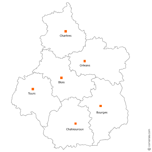
Station service en région Centre-Val-de-Loire
192 stations services sont référencés sur la région Centre-Val-de-Loire
Vous recherchez une pompe à essence en Centre-Val-de-Loire ?
La région Centre-Val-de-Loire représente 3% des stations services de France.
C'est le département du Loiret qui compte le plus de stations services en Centre-Val-de-Loire.
C'est le département du Loiret qui compte le plus de stations services en Centre-Val-de-Loire.
Station service dans le Cher (18)
Secteur de Bourges
Indice d'implantation
| Commune | Nb Pro | Habitants | Distance | |
|---|---|---|---|---|
| Bourges - 18000 | 4 | 67189 | 0,0 | km |
| Saint-Doulchard - 18230 | 1 | 9295 | 4,0 | km |
| Saint-Germain-du-Puy - 18390 | 2 | 5039 | 6,9 | km |
| Levet - 18340 | 1 | 1383 | 17,2 | km |
Secteur de Saint-Amand-Montrond
Indice d'implantation
| Commune | Nb Pro | Habitants | Distance | |
|---|---|---|---|---|
| Saint-Amand-Montrond - 18200 | 1 | 10238 | 0,0 | km |
| Orval - 18200 | 2 | 1882 | 1,8 | km |
| Farges-Allichamps - 18200 | 2 | 228 | 8,6 | km |
| Saint-Hilaire-en-Lignières - 18160 | 1 | 521 | 25,1 | km |
| Sancoins - 18600 | 1 | 3202 | 33,8 | km |
Station service dans l'Indre (36)
Secteur de Châteauroux
Indice d'implantation
| Commune | Nb Pro | Habitants | Distance | |
|---|---|---|---|---|
| Châteauroux - 36000 | 3 | 45209 | 0,0 | km |
| Déols - 36130 | 1 | 7889 | 2,1 | km |
| Saint-Maur - 36250 | 1 | 3531 | 4,5 | km |
| Villedieu-sur-Indre - 36320 | 1 | 2774 | 12,6 | km |
| Luant - 36350 | 1 | 1469 | 13,8 | km |
| Neuvy-Saint-Sépulchre - 36230 | 1 | 1664 | 25,3 | km |
| Montgivray - 36400 | 1 | 1685 | 31,6 | km |
| Meunet-sur-Vatan - 36150 | 1 | 191 | 32,4 | km |
| la Châtre - 36400 | 1 | 4289 | 33,8 | km |
| Aigurande - 36140 | 2 | 1504 | 43,1 | km |
| Saint-Benoît-du-Sault - 36170 | 1 | 622 | 47,3 | km |
Station service en Indre-et-Loire (37)
Secteur de Tours
Indice d'implantation
| Commune | Nb Pro | Habitants | Distance | |
|---|---|---|---|---|
| Tours - 37000 | 14 | 134803 | 0,0 | km |
| la Riche - 37520 | 1 | 10276 | 1,4 | km |
| Saint-Cyr-sur-Loire - 37540 | 1 | 16239 | 1,8 | km |
| Saint-Pierre-des-Corps - 37700 | 4 | 15404 | 2,8 | km |
| Joué-lès-Tours - 37300 | 2 | 37703 | 4,9 | km |
| Fondettes - 37230 | 1 | 10193 | 6,3 | km |
| Chambray-lès-Tours - 37170 | 1 | 10881 | 6,5 | km |
| Ballan-Miré - 37510 | 1 | 7987 | 7,9 | km |
| Chanceaux-sur-Choisille - 37390 | 1 | 3520 | 8,9 | km |
| Druye - 37190 | 1 | 975 | 14,4 | km |
Secteur de Monts
Indice d'implantation
| Commune | Nb Pro | Habitants | Distance | |
|---|---|---|---|---|
| Monts - 37260 | 0 | 7471 | 0,0 | km |
| Azay-le-Rideau - 37190 | 1 | 3414 | 12,1 | km |
| Esvres - 37320 | 2 | 5181 | 12,1 | km |
| Saint-Épain - 37800 | 1 | 1572 | 16,0 | km |
| Cheillé - 37190 | 2 | 1759 | 16,6 | km |
| Benais - 37140 | 1 | 981 | 31,0 | km |
| Marigny-Marmande - 37120 | 1 | 579 | 34,3 | km |
| Gizeux - 37340 | 1 | 408 | 35,0 | km |
Secteur de Loches
Indice d'implantation
| Commune | Nb Pro | Habitants | Distance | |
|---|---|---|---|---|
| Loches - 37600 | 0 | 6343 | 0,0 | km |
| Chambourg-sur-Indre - 37310 | 1 | 1372 | 6,3 | km |
| Genillé - 37460 | 1 | 1591 | 9,9 | km |
| Louans - 37320 | 1 | 627 | 19,9 | km |
Secteur de Montlouis-sur-Loire
Indice d'implantation
| Commune | Nb Pro | Habitants | Distance | |
|---|---|---|---|---|
| Montlouis-sur-Loire - 37270 | 0 | 10787 | 0,0 | km |
| Athée-sur-Cher - 37270 | 1 | 2689 | 9,8 | km |
| Monnaie - 37380 | 2 | 4206 | 13,4 | km |
Secteur d'Amboise
Indice d'implantation
| Commune | Nb Pro | Habitants | Distance | |
|---|---|---|---|---|
| Amboise - 37400 | 1 | 13246 | 0,0 | km |
| Villedômer - 37110 | 1 | 1391 | 17,0 | km |
Station service dans le Loir-et-Cher (41)
Secteur de Blois
Indice d'implantation
| Commune | Nb Pro | Habitants | Distance | |
|---|---|---|---|---|
| Blois - 41000 | 5 | 45539 | 0,0 | km |
| Saint-Gervais-la-Forêt - 41350 | 1 | 3285 | 3,3 | km |
| Vineuil - 41350 | 2 | 7508 | 3,8 | km |
| Chailles - 41120 | 1 | 2574 | 5,3 | km |
| Villerbon - 41000 | 3 | 794 | 9,0 | km |
| Monthou-sur-Cher - 41400 | 1 | 971 | 27,2 | km |
| Montrichard - 41400 | 1 | 3995 | 29,2 | km |
| Chissay-en-Touraine - 41400 | 1 | 1164 | 31,6 | km |
| Saint-Georges-sur-Cher - 41400 | 2 | 2585 | 33,1 | km |
Secteur de Romorantin-Lanthenay
Indice d'implantation
| Commune | Nb Pro | Habitants | Distance | |
|---|---|---|---|---|
| Romorantin-Lanthenay - 41200 | 1 | 16891 | 0,0 | km |
| Villefranche-sur-Cher - 41200 | 1 | 2764 | 7,8 | km |
| Gy-en-Sologne - 41230 | 1 | 510 | 12,5 | km |
| Selles-sur-Cher - 41130 | 1 | 4621 | 17,1 | km |
| la Ferté-Beauharnais - 41210 | 1 | 522 | 21,6 | km |
| Theillay - 41300 | 2 | 1319 | 22,7 | km |
| Saint-Romain-sur-Cher - 41140 | 1 | 1503 | 26,5 | km |
| Lamotte-Beuvron - 41600 | 2 | 4798 | 34,1 | km |
Secteur de Mer
Indice d'implantation
| Commune | Nb Pro | Habitants | Distance | |
|---|---|---|---|---|
| Mer - 41500 | 0 | 6200 | 0,0 | km |
| Cour-sur-Loire - 41500 | 2 | 284 | 8,6 | km |
Secteur de Vendôme
Indice d'implantation
| Commune | Nb Pro | Habitants | Distance | |
|---|---|---|---|---|
| Vendôme - 41100 | 1 | 17121 | 0,0 | km |
| Saint-Ouen - 41100 | 1 | 3333 | 2,3 | km |
Station service dans l'Eure-et-Loir (28)
Secteur de Chartres
Indice d'implantation
| Commune | Nb Pro | Habitants | Distance | |
|---|---|---|---|---|
| Chartres - 28000 | 6 | 38840 | 0,0 | km |
| Lucé - 28110 | 1 | 16149 | 2,1 | km |
| Lèves - 28300 | 1 | 5657 | 2,8 | km |
| Nogent-le-Phaye - 28630 | 3 | 1342 | 6,2 | km |
| Gasville-Oisème - 28300 | 2 | 1340 | 6,5 | km |
| Amilly - 28300 | 1 | 1856 | 7,1 | km |
| Saint-Georges-sur-Eure - 28190 | 1 | 2422 | 10,5 | km |
| Bailleau-le-Pin - 28120 | 1 | 1504 | 14,8 | km |
| Maintenon - 28130 | 1 | 4357 | 17,4 | km |
| Fresnay-l'Évêque - 28310 | 4 | 743 | 31,8 | km |
| Janville - 28310 | 1 | 2 | 40,0 | km |
Secteur de Dreux
Indice d'implantation
| Commune | Nb Pro | Habitants | Distance | |
|---|---|---|---|---|
| Dreux - 28100 | 3 | 31373 | 0,0 | km |
| Vernouillet - 28500 | 1 | 12047 | 1,5 | km |
| Cherisy - 28500 | 1 | 1851 | 4,2 | km |
| le Boullay-Mivoye - 28210 | 1 | 453 | 9,4 | km |
| Saint-Rémy-sur-Avre - 28380 | 1 | 3831 | 10,0 | km |
| Saussay - 28260 | 1 | 1069 | 14,4 | km |
| Châteauneuf-en-Thymerais - 28170 | 1 | 2640 | 19,1 | km |
| Maillebois - 28170 | 2 | 957 | 19,6 | km |
Secteur de Châteaudun
Indice d'implantation
| Commune | Nb Pro | Habitants | Distance | |
|---|---|---|---|---|
| Châteaudun - 28200 | 0 | 13226 | 0,0 | km |
| Saint-Denis-les-Ponts - 28200 | 1 | 2 | 3,2 | km |
| Cloyes-sur-le-Loir - 28220 | 1 | 2762 | 11,0 | km |
| Frazé - 28160 | 1 | 508 | 27,1 | km |
| Santilly - 28310 | 2 | 355 | 41,1 | km |
Station service dans le Loiret (45)
Secteur d'Orléans
Indice d'implantation
| Commune | Nb Pro | Habitants | Distance | |
|---|---|---|---|---|
| Orléans - 45000 | 9 | 114375 | 0,0 | km |
| Saint-Jean-de-la-Ruelle - 45140 | 3 | 16488 | 2,5 | km |
| Fleury-les-Aubrais - 45400 | 3 | 20677 | 2,9 | km |
| Saint-Jean-de-Braye - 45800 | 1 | 19571 | 4,4 | km |
| Semoy - 45400 | 1 | 3287 | 4,5 | km |
| Olivet - 45160 | 1 | 20458 | 4,5 | km |
| la Chapelle-Saint-Mesmin - 45380 | 1 | 10078 | 5,5 | km |
| Saran - 45770 | 1 | 15449 | 5,6 | km |
| Ingré - 45140 | 2 | 8282 | 6,0 | km |
| Chécy - 45430 | 1 | 8756 | 8,9 | km |
| Cercottes - 45520 | 1 | 1397 | 9,3 | km |
| Mardié - 45430 | 1 | 2510 | 11,4 | km |
Secteur de Montargis
Indice d'implantation
| Commune | Nb Pro | Habitants | Distance | |
|---|---|---|---|---|
| Montargis - 45200 | 1 | 14326 | 0,0 | km |
| Châlette-sur-Loing - 45120 | 2 | 12812 | 1,7 | km |
| Villemandeur - 45700 | 1 | 6813 | 3,0 | km |
| Amilly - 45200 | 1 | 12232 | 3,1 | km |
| la Selle-en-Hermoy - 45210 | 2 | 830 | 11,1 | km |
| Fontenay-sur-Loing - 45210 | 1 | 1757 | 11,8 | km |
| Château-Renard - 45220 | 1 | 2239 | 15,3 | km |
| Courtenay - 45320 | 1 | 4059 | 23,7 | km |
| Châtillon-sur-Loire - 45360 | 1 | 3145 | 45,2 | km |
Secteur de Beaugency
Indice d'implantation
| Commune | Nb Pro | Habitants | Distance | |
|---|---|---|---|---|
| Beaugency - 45190 | 3 | 7519 | 0,0 | km |
| Messas - 45190 | 2 | 871 | 3,4 | km |
| Baule - 45130 | 1 | 2044 | 4,7 | km |
| Lailly-en-Val - 45740 | 1 | 2901 | 4,8 | km |
Secteur de Châteauneuf-sur-Loire
Indice d'implantation
| Commune | Nb Pro | Habitants | Distance | |
|---|---|---|---|---|
| Châteauneuf-sur-Loire - 45110 | 0 | 7906 | 0,0 | km |
| Saint-Denis-de-l'Hôtel - 45550 | 2 | 2931 | 7,2 | km |
| Jargeau - 45150 | 1 | 4499 | 7,6 | km |
| Bonnée - 45460 | 1 | 673 | 14,3 | km |
Secteur de Malesherbois
Indice d'implantation
| Commune | Nb Pro | Habitants | Distance | |
|---|---|---|---|---|
| Malesherbes - 45330 | 0 | 8114 | 0,0 | km |
| Beaune-la-Rolande - 45340 | 2 | 1986 | 25,2 | km |
Secteur de Ferté-Saint-Aubin
Indice d'implantation
| Commune | Nb Pro | Habitants | Distance | |
|---|---|---|---|---|
| la Ferté-Saint-Aubin - 45240 | 0 | 7219 | 0,0 | km |
| Marcilly-en-Villette - 45240 | 1 | 2040 | 8,0 | km |